


ADC Amazing days are coming!
ADC Amazing days are coming!


Joined:
X days ago
# Posts:
X,XXX
Contributor Points:
X





Replies:



 West-Tex: I'm sure that Saturday's weather will inspire many folks to break out their fall and/or Halloween decor!

|

#msg2209748MooMaw : Have you decorated yet?
West-Tex : Yes…I did last week…Fall/halloween. I feel accomplished…..if not for my grandluvs. I don't put out half of the stuff I used to. The older you get less is more. We even did Halloween crafts this past weekend. We make ghost cookies using nutter butter cookies and they decorated a bag with Halloween stickers. 😎
I've had my fall stuff out since mid Sept. I don't do Halloween .. That was pretty early for me, but since i like to get on with Christmas Tgiving week, I can enjoy it more.
West-Tex and KathyMarshall reacted  Floyd
Floyd
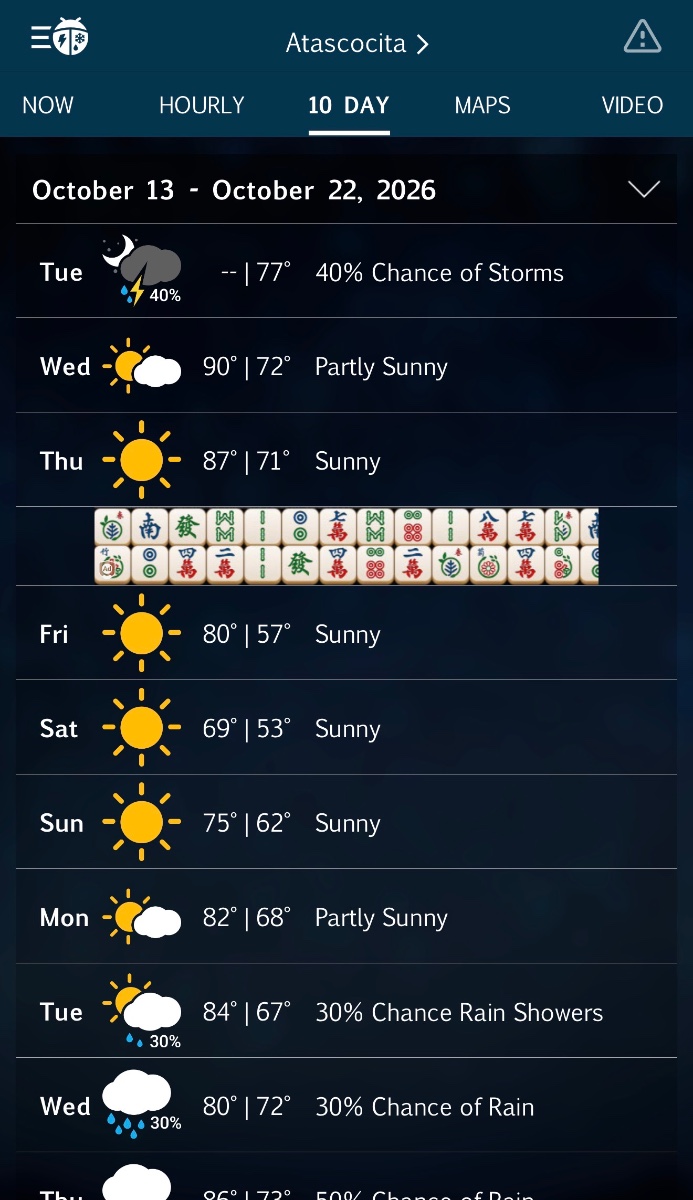
Strong cold front arrives Friday ending record heat in Houston HOUSTON, Texas (KTRK) -- We've got one more day of summer-like heat to endure before a strong cold front arrives Friday morning. This front will blow in exceptional weather for the weekend along with our coldest temperatures since early April! It will remain warm overnight, but lows will bottom out closer to 70 than 80 thanks to the departure of steamy tropical air. It will be another hot October day with a high just above 90, but the humidity won't be as high as it was earlier in the week. Rain chances are just 10% or less. During the day we will be tracking a cold front pushing into Texas, but it shouldn't reach Houston until after sunrise Friday morning. How cool will it get behind Friday's front? On Friday, temperatures will start near 70 then struggle to warm above 80 as a strong north wind develops behind the front. Winds will be sustained up to 30 mph with gust up to 40 mph, especially west of I-45. By evening, temperatures will be in the 60s, and it will still be breezy. We recommend sporting a jacket to all the Friday night football games and outdoor activities. On Saturday it will be significantly cooler with lows in the low 50s and highs only in the mid 70s under a sunny sky. The wind will settle down Saturday night, and that will lead to our coldest temperatures from this front on Sunday morning. Expect widespread lows in upper 40s and low 50s, which would be the coldest morning since early April! On Sunday afternoon, temperatures will warm into the upper 70s. It now looks like this front is so strong it will hold off the return of tropical air for several days, so going back to work and school and Monday it should still feel like fall with a low in the mid 50s and a high near 80. What do rain chances look like with this pattern change? There's a small chance we see a quick passing shower with Friday's front as it swings through Southeast Texas in the morning. But besides that, this front is paving the way for a much drier outlook that will have some staying power even into next week. At this time we only have about a 20-30% chance for showers and storms Tuesday and Wednesday of next week. What are you tracking in the tropics? We are tracking two Pacific storms, a hurricane named Simon and a tropical storm named Trudy. Originally it looked like both storms would curve into Mexico and send moisture into Texas, but it now looks like both will curve away from Mexico and avoid sending moisture into Texas next week. The Atlantic remains quiet with no development expected over the next 7 days. For a more in-depth discussion on what's happening in the tropics, visit our Daily Tropical Update page.
abc13.com/post/houst on-weather-forecast- today-near-me-texas- rain-storm-pred
Luckysis and MooMaw reacted abc13.com/post/houst on-weather-forecast- today-near-me-texas- rain-storm-pred
|
|
Weather wise it's like it's Christmas Eve. Getting excited for the weather tomorrow
West-Tex, Luckysis and Floyd reacted 
« Back to Chat
Views: 175
# Replies: 19